

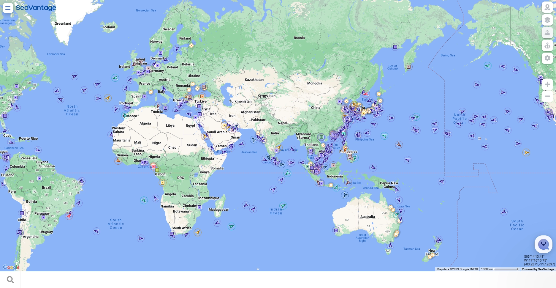
Map Screen
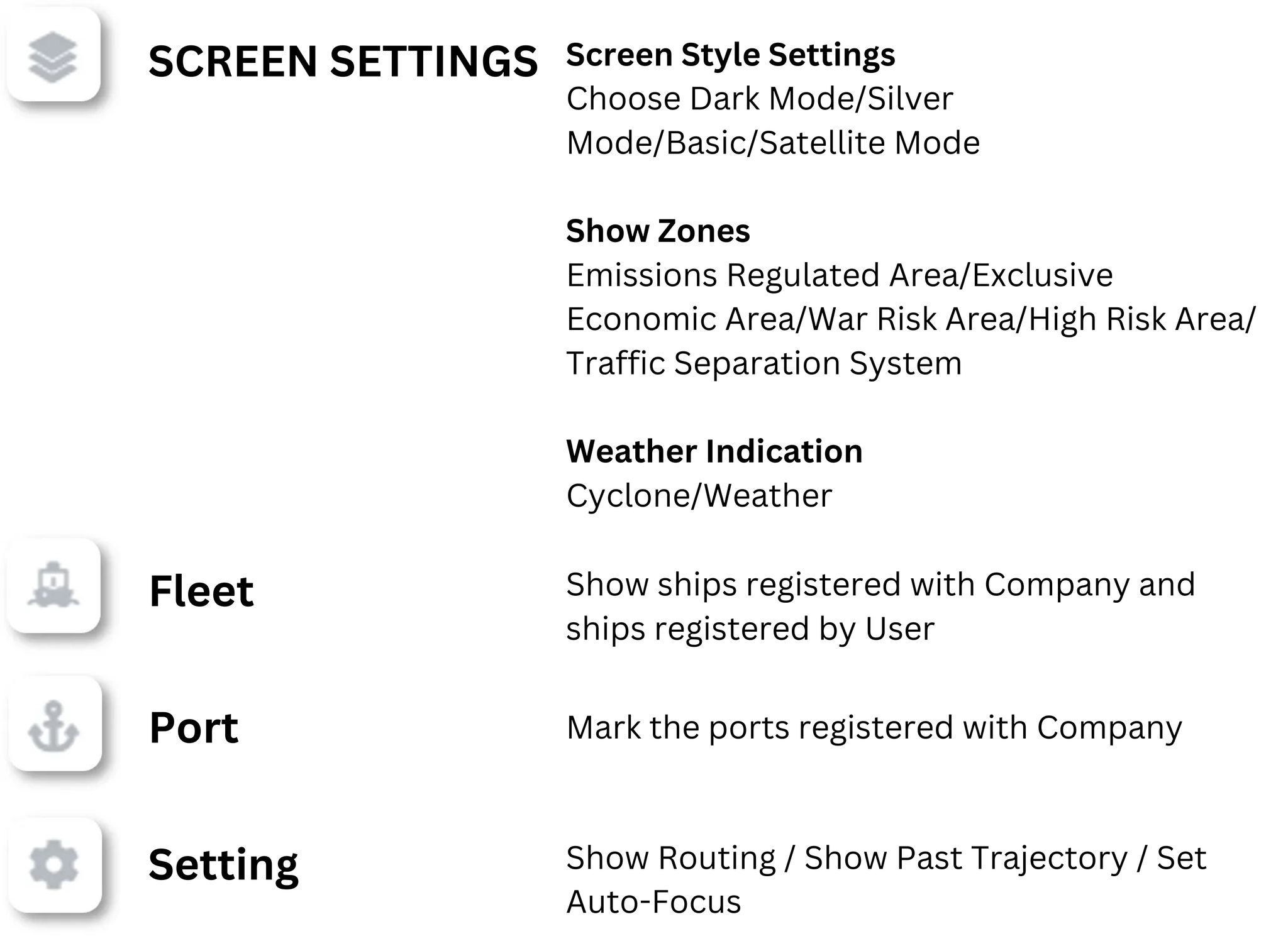
The map displays vessels registered under the Company filter, ports, and vessels added by the user to My Fleet. Additionally, various settings such as weather and regions can be customized.
Can't see any vessels or ports?
Try registering a vessel, or if one is already registered, simply turn on the vessel display in the settings!
For port display, ports must be registered under the Company in Port Insight to appear on the map.
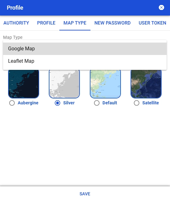
Map Styles
•
Users can choose from a total of 2 map types - Google and Leaflet.
◦
Google Maps: 4 basic map styles available
◦
Leaflet Map: Choose 4 of 7 map styles to use
•
In User Information > Map Type, select the map style you want to use and save it.
•
Your newly changed map style will be set after you log out and log back in.
•
You can change and use the map style specified in the control box at the top right of the map screen.
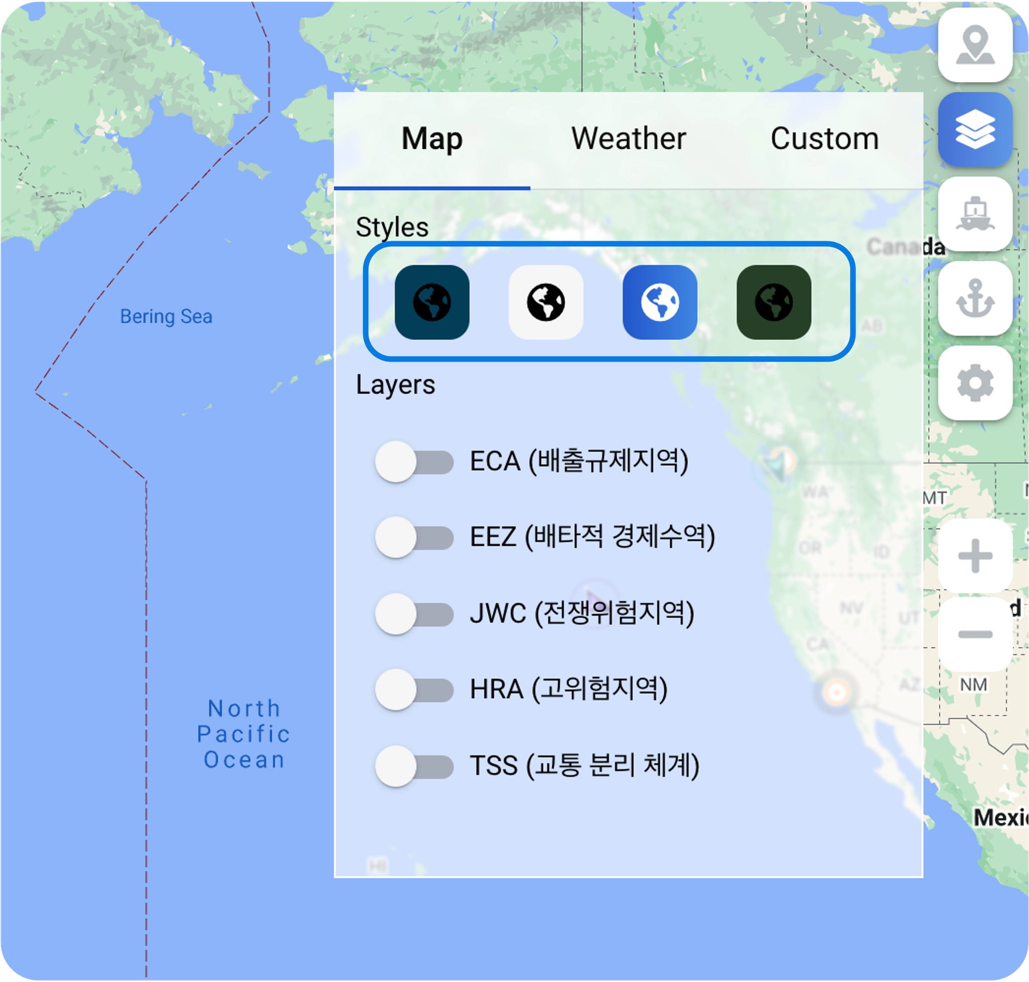
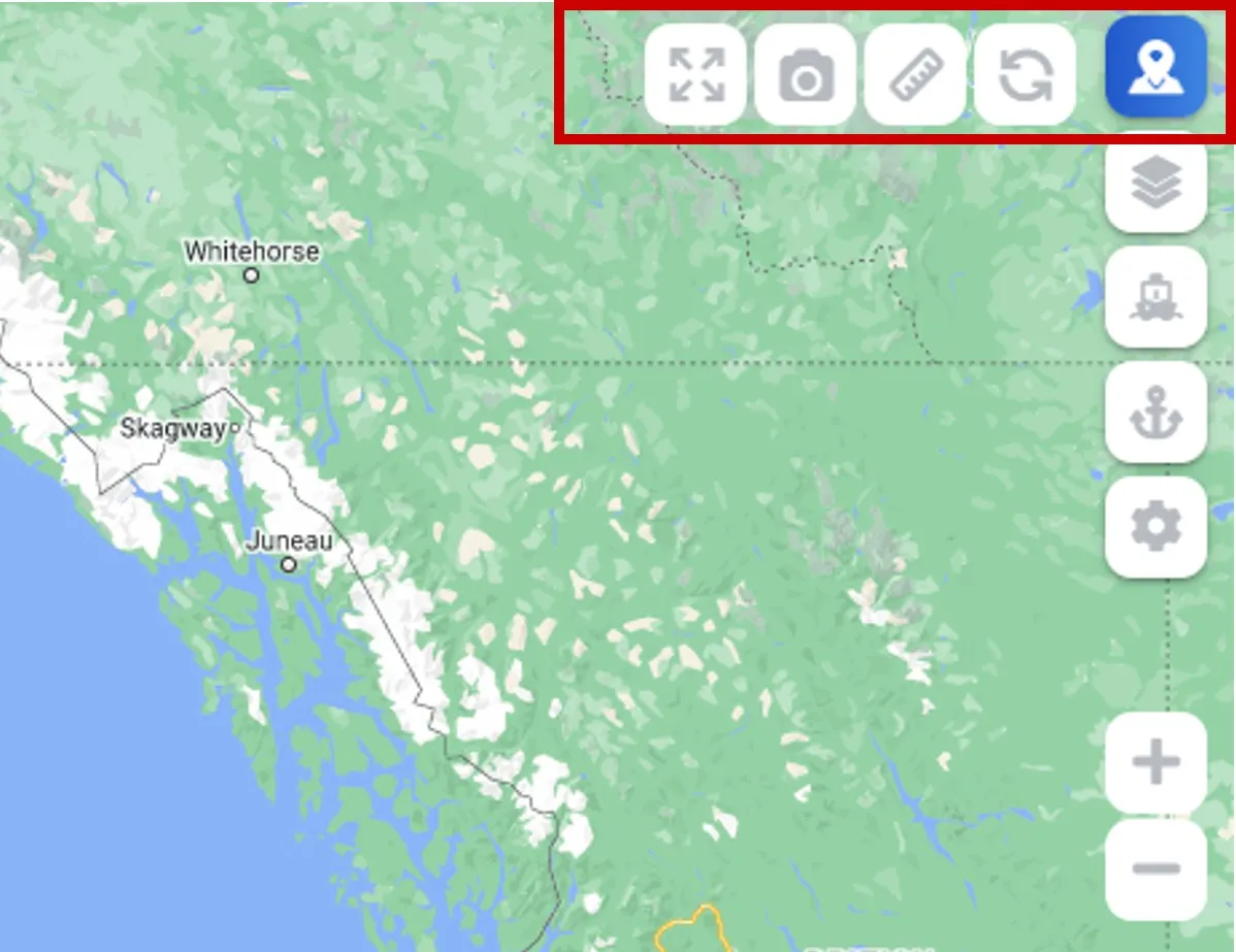
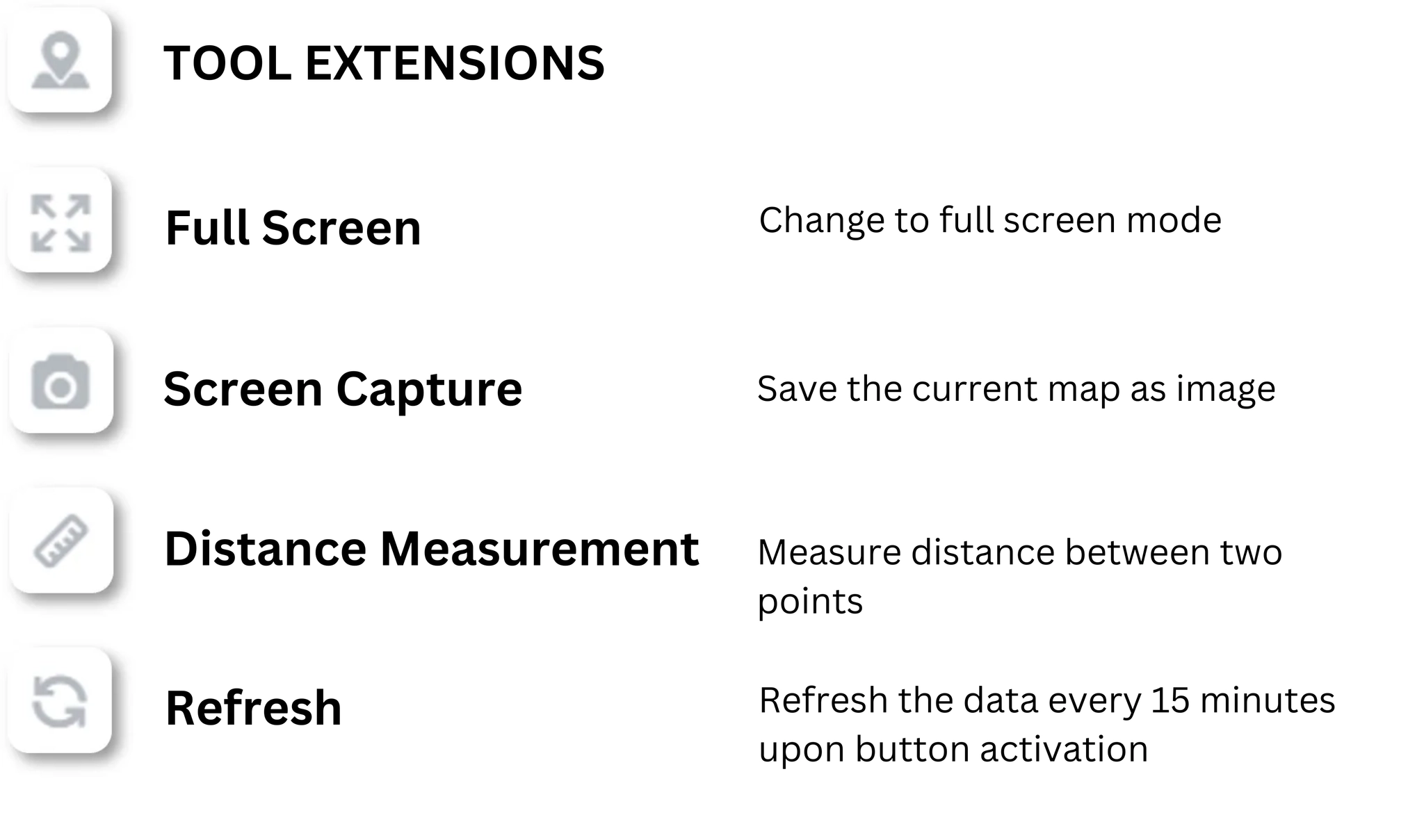
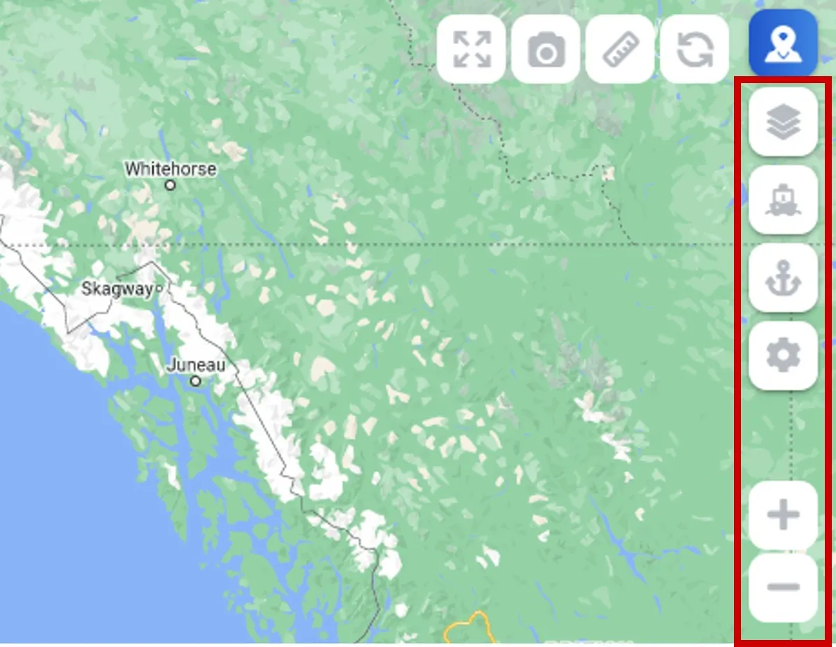
Control Box
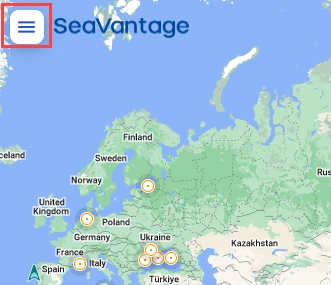
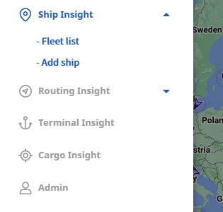
Move the Menu
•
Click the menu button in the top left corner of the screen to navigate to the desired menu.
•
The menu organization you see depends on the solution your company uses.
•
Only users with Admin permissions see the Admin menu.
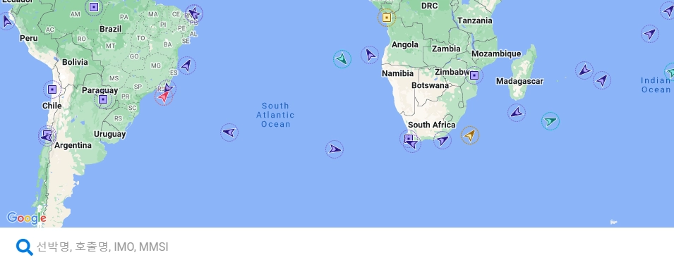
Search Bar
Use the search bar at the bottom to quickly find information by entering the vessel name, call sign, IMO, or MMSI.